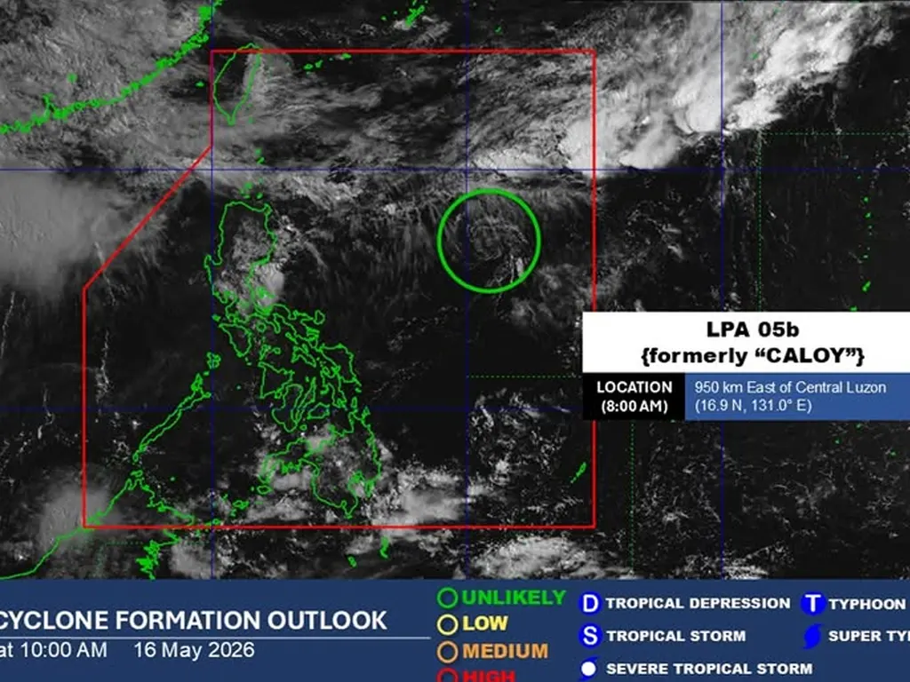
AS of 8:00 a.m. today, 16 May 2026, the Low Pressure Area (LPA) formerly known as “Caloy” — continues to be monitored within the Philippine Area of Responsibility (PAR). According to the latest weather update, the weather system remains less organized and is assessed as unlikely to redevelop or intensify into a tropical depression within the next 24 hours.
State weather bureau noted that current environmental conditions, including moderate wind shear and limited moisture convergence, are inhibiting its potential to strengthen into a more organized cyclone.
While it is not expected to develop further, the LPA will still bring scattered rain showers and thunderstorms over parts of the country, particularly the eastern sections of Visayas and Mindanao, as well as the Bicol Region.
Residents in these areas are advised to stay updated on subsequent bulletins and take necessary precautions against possible flash floods or landslides, especially in low‑lying and mountainous terrain. PAGASA continues to track the movement and evolution of the system and will issue further announcements should there be significant changes in its status or track.
metrosundaily

