
TROPICAL Storm Maymay, with the international name Kujira, maintained its strength on Wednesday afternoon as it tracked north‑northeastward over the coastal waters west of Ilocos Sur, prompting the state weather bureau to keep Signal No. 2 raised across parts of Northern Luzon.
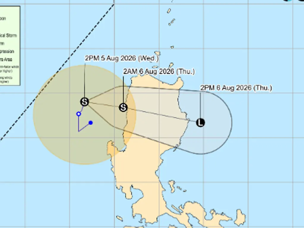
In its 5:00 p.m. advisory issued August 5, the Philippine Atmospheric, Geophysical and Astronomical Services Administration (PAGASA) placed the storm’s center approximately 145 kilometers west of Sinait, Ilocos Sur.
Maymay carried maximum sustained winds of 75 kilometers per hour near the center and gusts reaching up to 90 kilometers per hour, while moving slowly at 10 kilometers per hour toward the north‑northeast. PAGASA warned that the storm may make landfall along the Ilocos Norte–Ilocos Sur–La Union area by late Wednesday or early Thursday morning. Upon crossing land, Maymay is expected to traverse Northern and Central Luzon, bringing inclement weather to wide sections of the island.
Communities under storm signals are advised to take precautionary measures, secure properties, and avoid coastal and mountainous areas prone to hazards. Heavy rainfall, strong winds, and rough sea conditions are forecast along the storm’s path, raising risks of flash floods, landslides, and storm surges. PAGASA continues to monitor Maymay’s movement and intensity, with regular updates to be issued as the situation evolves.
metrosundaily