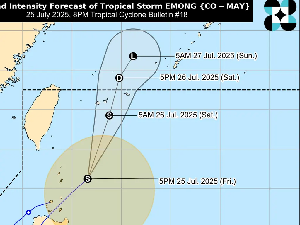
AS of 7:00 PM, Tropical Storm Emong was located approximately 195 kilometers east of Itbayat, Batanes (21.1°N, 123.7°E), moving north-northeastward at 40 km/h.
The storm’s maximum sustained winds were recorded at 85 km/h near the center, with gusts reaching up to 105 km/h, and a central pressure of 992 hPa. Strong to gale-force winds extend outwards up to 400 km from the center. Tropical Cyclone Wind Signal No. 1 remains in effect for Batanes, Babuyan Islands, and the northeastern portion of mainland Cagayan (Santa Ana), indicating strong winds with minimal to minor threats to life and property.
Despite moving away from Batanes, Emong’s influence continues to affect the country. Heavy rainfall is expected in various areas due to the combined effects of Emong and the enhanced southwest monsoon.
A Gale Warning is in effect over the seaboard of Northern Luzon, with significant wave heights predicted for Batanes, Babuyan Islands, and the northern seaboard of mainland Cagayan. Sea travel is considered risky for all types and sizes of vessels, and mariners are advised to remain in port or seek shelter until conditions improve.
The enhanced southwest monsoon will also bring strong to gale-force winds to several areas across Luzon, Visayas, and Dinagat Islands, particularly in coastal and upland regions.
Residents in areas affected by the storm are urged to continue monitoring weather updates and heed all advisories issued by local authorities.
While Emong’s direct impact on Batanes is diminishing, the potential for heavy rainfall, strong winds, and high waves persists, necessitating continued vigilance and preparedness. The combination of Emong and the southwest monsoon poses a significant weather threat across a large portion of the Philippines.
metrosundaily

