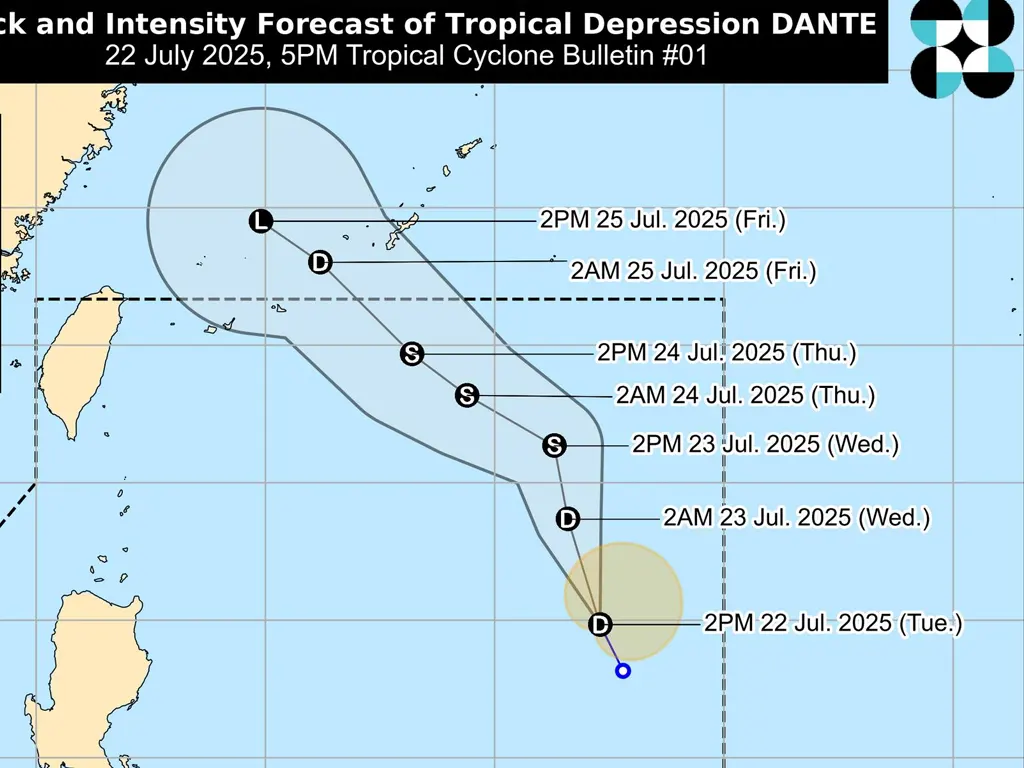
TROPICAL Depression Dante has formed east of Aurora, bringing the potential for strong winds and heavy rainfall across the Philippines. As of 4:00 PM today, Dante’s center was estimated at 1,115 km East Northeast of Central Luzon or 1,130 km East of Northern Luzon (18.3°N, 132.4°E).
The depression has maximum sustained winds of 45 km/h near its center, with gusts reaching up to 55 km/h. Its central pressure is 1000 hPa, and it is moving North northwestward at 20 km/h. Strong winds extend outwards up to 220 km from the center.
No Tropical Cyclone Wind Signals (TCWS) are currently hoisted.
While no TCWS are currently in effect, the enhanced Southwest Monsoon, further intensified by Dante, a separate LPA east of Batanes, and Typhoon WIPHA over Vietnam, pose significant threats.
Heavy rainfall is expected, and details are available in Weather Advisory No. 29. Strong to gale-force gusts will affect various areas, particularly coastal and upland regions. These areas include Zambales, Bataan, Metro Manila, CALABARZON, MIMAROPA, Visayas, and Dinagat Islands today.
The strong winds will continue into tomorrow, July 23, impacting the Ilocos Region, Zambales, Bataan, Bulacan, Metro Manila, CALABARZON, MIMAROPA, Visayas, Zamboanga del Norte, Misamis Occidental, Lanao del Norte, Camiguin, and Dinagat Islands.
These strong winds are also forecast to persist into Thursday, July 24, affecting the Ilocos Region, Abra, Benguet, Central Luzon, Metro Manila, CALABARZON, MIMAROPA, Visayas, Zamboanga del Norte, Misamis Occidental, Lanao del Norte, Camiguin, and Dinagat Islands. Residents in these areas are urged to take necessary precautions and monitor weather updates closely.
metrosundaily

