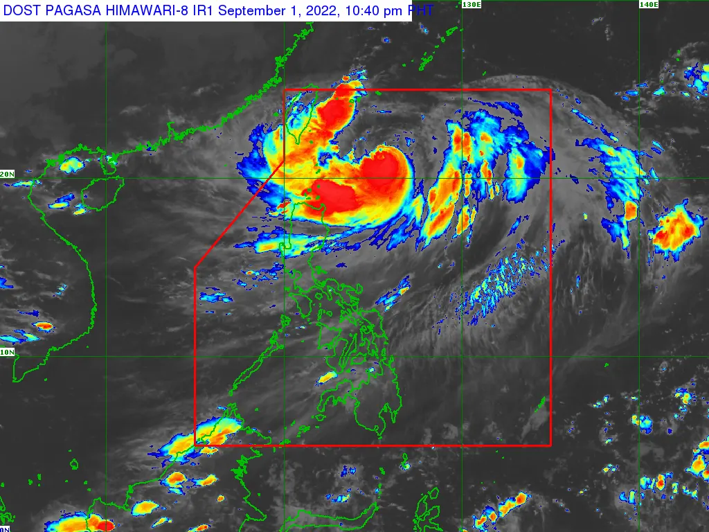
THE center of the eye of Super Typhoon “HENRY” was estimated based on all available data at 380 km East of Itbayat, Batanes (21.1°N, 125.5°E)
• Intensity:
Maximum sustained winds of 185 km/h near the center, gustiness of up to 230 km/h, and central pressure of 925 hPa
• Present Movement:
Southward at 10 km/h
• Extent of Tropical Cyclone Winds:
Strong to typhoon-force winds extend outwards up to 440 km from the center
TROPICAL CYCLONE WIND SIGNALS (TCWS) IN EFFECT
TCWS No.1
(Strong winds prevailing or expected within 36 hours)
LUZON:
Batanes and the northeastern portion of Babuyan Islands (Babuyan Is.)
Potential impacts of winds: Minimal to minor threat to life and property.
HAZARDS AFFECTING LAND AREAS
Heavy Rainfall
• Tonight through tomorrow: Moderate to heavy rains with at times intense likely over Batanes and Babuyan Islands. Light to moderate with at times heavy rains possible over Ilocos Norte, Apayao, and Cagayan.
• Saturday early morning through afternoon: Moderate to heavy rains possible over Batanes. Light to moderate with at times heavy rains possible over Babuyan Islands.
• Under these conditions, isolated to scattered flooding (including flash floods) and rain-induced landslides are possible especially in areas that are highly or very highly susceptible to these hazard as identified in hazard maps, and in localities with significant antecedent rainfall.
• This tropical cyclone is also forecast to enhance the Southwest Monsoon which may bring rains over the western section of Luzon beginning tomorrow. As such, the issuance of Weather Advisory for Southwest Monsoon is likely.
Severe Winds
Strong winds (strong breeze to near gale strength) will be experienced within any of the areas where Wind Signal no. 1 is currently in effect. The potential for hoisting a Wind Signal No. 2 is also not ruled out.
HAZARDS AFFECTING COASTAL WATERS
• Under the influence of Super Typhoon HENRY, a Gale Warning is in effect for the northern and eastern seaboards of Northern Luzon. For more information, refer to Gale Warning #2 issued at 5:00 PM today.
• In the next 24 hours, HENRY may bring moderate to rough seas over the eastern seaboards of Isabela (2.0 to 4.0 m), Central Luzon, and Southern Luzon (1.2 to 3.0 m). These conditions may be risky for those using small seacrafts. Mariners are advised to take precautionary measures when venturing out to sea and, if possible, avoid navigating in these conditions.
TRACK AND INTENSITY OUTLOOK
• Super Typhoon HENRY is forecast to continue decelerating and may become almost stationary tomorrow morning. HENRY may begin tracking slowly northwestward by tomorrow afternoon before eventually accelerating northward by Saturday. On the forecast track, HENRY may exit the Philippine Area of Responsibility on Saturday evening or Sunday morning.
• This super typhoon is forecast to weaken as it continues to slow down and enter its quasi-stationary phase. A short period of intensification may also take place by Sunday as HENRY tracks northward over the East China Sea.
Considering these developments, the public and disaster risk reduction and management offices concerned are advised to take all necessary measures to protect life and property. Persons living in areas identified to be highly or very highly susceptible to these hazards are advised to follow evacuation and other instructions from local officials. For heavy rainfall warnings, thunderstorm/rainfall advisories, and other severe weather information specific to your area, please monitor products issued by your local PAGASA Regional Services Division.
metrosundaily

