TROPICAL Depression ‘Chedeng’ is unlikely to directly bring heavy rainfall over any portion of the country in the next 3 to 5 days.
Although the current forecast scenario for this tropical cyclone may result in the enhancement of the Southwest Monsoon, the timing and intensity of monsoon rains over the country (especially in the western portion) may still change due to the dependence of monsoon enhancement on the forecast movement and intensity of ‘Chedeng’ and its interaction with the other weather systems surrounding it.
As such, the public is advised to continue monitoring for updates regarding the possible enhancement of the Southwest Monsoon. A Weather Advisory will be issued by Pagasa should there be an increasing chance of monsoon heavy rainfall within the next three days.
The hoisting of Wind Signals in anticipation of tropical cyclone severe winds is unlikely at this time.
The Southwest Monsoon may be strengthened as a result of ‘Chedeng’, but under the current forecast scenario, the likelihood of intermittent wind gusts resulting from the monsoon winds may still change because the monsoon enhancement depends on the forecast movement and intensity of ‘Chedeng’ and its interaction with the other weather systems around it. As such, the public is advised to continue monitoring for updates regarding the possible enhancement of the Southwest Monsoon.
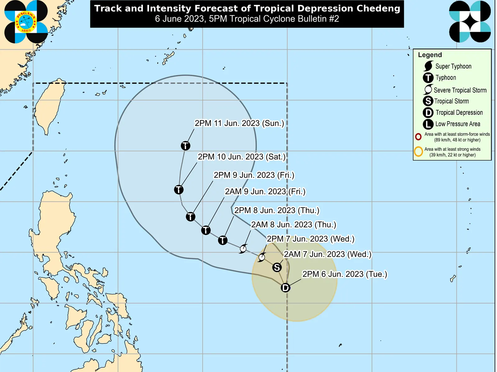
As ‘Chedeng’ continues to consolidate while intensifying, it is forecast to gradually accelerate and move generally northwestward in the next 24 hours before turning west northwestward on Thursday. Afterwards, the tropical cyclone will begin turning towards the northwest on Friday and to the north during the weekend. Throughout the forecast period, ‘Chedeng’ will remain far from the Philippine landmass.
Owing to favorable environmental conditions, ‘Chedeng’ is forecast to intensify in the next 4 days and may be upgraded to tropical storm category in the next 12 hours. This tropical cyclone may reach typhoon category by Thursday and reach its peak intensity on Friday or during the weekend while over the Philippine Sea east of Northern Luzon.
metrosundaily

