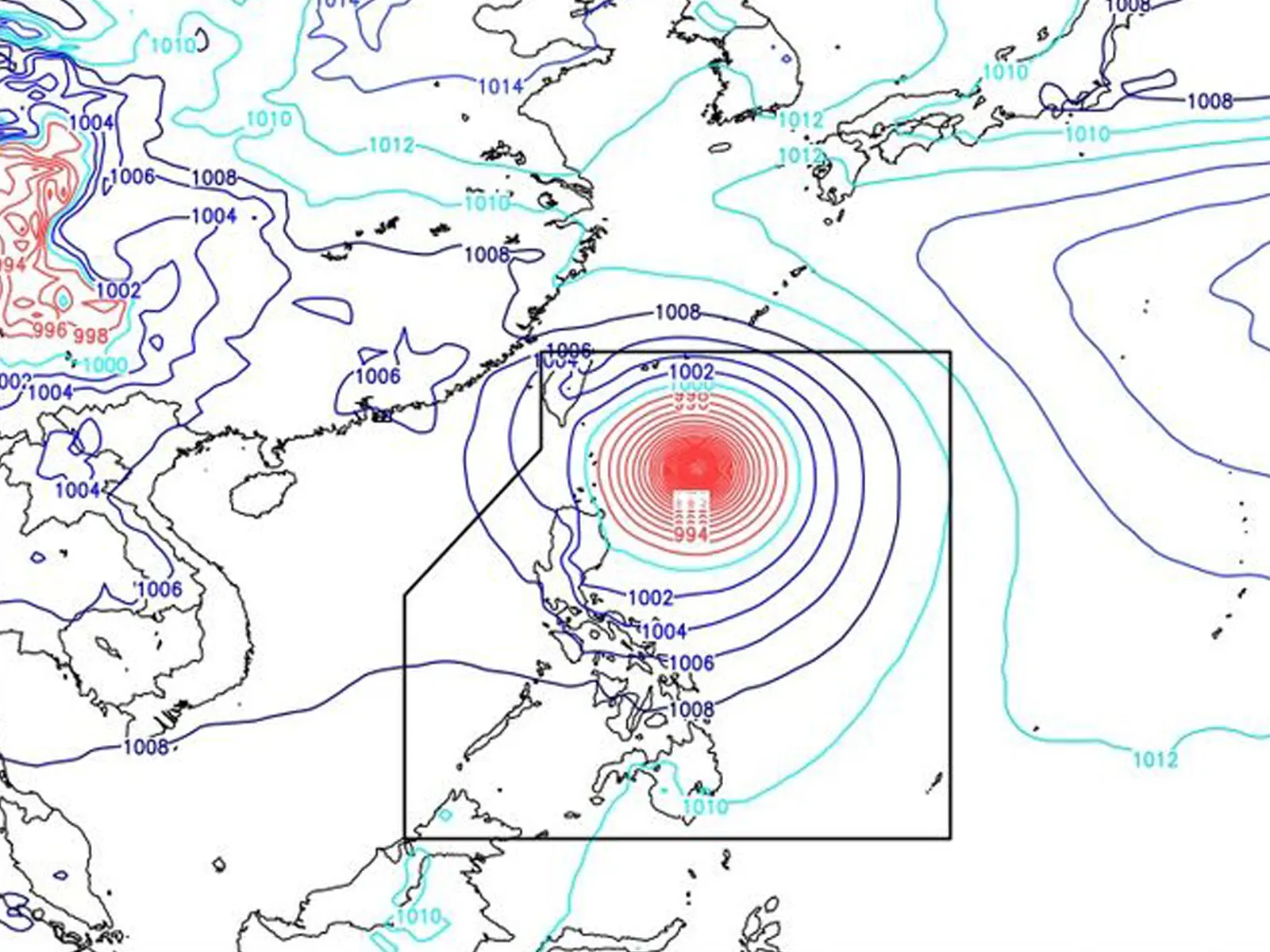
AT 3:00 PM today, the center of the eye of Typhoon “BETTY” {MAWAR} was estimated based on all available data at 425 km East of Calayan, Cagayan (19.5°N, 125.8°E) with maximum sustained winds of 155 km/h near the center and gustiness of up to 190 km/h. It is moving North Northwestward at 10 km/h. Southwest Monsoon affecting Southern Luzon and Visayas, and Mindanao.
Forecast Weather Conditions
Area: Batanes and Cagayan
Weather Condition: Stormy
Caused By: TY BETTY
Impacts: Possible flooding or landslides due to moderate to heavy to intense with at times torrential rains. Minor threat to moderate threat to lives and properties due to strong winds
Area: Ilocos Region, Cordillera Administrative Region, Isabela, Nueva Vizcaya, Quirino, and Aurora
Weather Condition: Rains with Gusty winds
Caused By: TY BETTY
Impacts: Possible flooding or landslides due to moderate to heavy with at times intense rains. Minimal to minor threat to lives and properties due to strong winds
Area: Western Visayas, Zamboanga Peninsula, BARMM, Occidental Mindoro, and Palawan
Weather Condition: Cloudy skies with scattered rainshowers and thunderstorms
Caused By: Southwest Monsoon
Impacts: Possible flash floods or landslides due to moderate to at times heavy rains
Area: Metro Manila and the rest of the country
Weather Condition: Partly cloudy to cloudy skies with isolated rainshowers or thunderstorms


