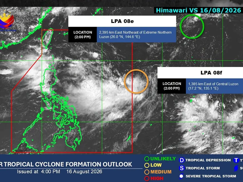
STATE weather bureau Pagasa confirmed on Sunday afternoon that two Low Pressure Areas (LPAs) are currently being monitored outside the Philippine Area of Responsibility (PAR). As of 2:00 p.m., the first disturbance — designated LPA 08e — was spotted approximately 2,395 kilometers east‑northeast of Extreme Northern Luzon. Forecasters noted that this system has a low probability of developing into a tropical depression within the next 24 hours as it remains far from land.
The second weather system, LPA 08f, was located about 1,385 kilometers east of Central Luzon at the same time. Unlike the first disturbance, Pagasa assessed that this LPA carries a medium chance of intensifying into a tropical depression within the next day. Authorities continue to track its movement and development closely, though both systems remain outside the country’s boundary and are not yet expected to directly impact local weather conditions.
Meanwhile, the broader weather pattern remains dominated by the Southwest Monsoon or Habagat. In its 4:00 p.m. bulletin, Pagasa warned that the monsoon will bring rains across Luzon and the western section of the Visayas on Monday, August 17. Residents in these areas are advised to stay alert for possible heavy showers, flash floods, and landslides, even as the two LPAs remain far out at sea. The weather bureau will continue issuing updates on both the monsoon rains and the evolution of the monitored disturbances.
metrosundaily