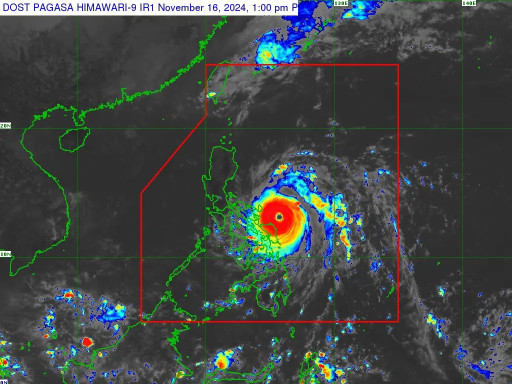
SUPER Typhoon Pepito, now a Category 5 storm, is rapidly intensifying and poses a catastrophic threat to northeastern Bicol. A wind signal no. 5 has been raised over Catanduanes, while northeastern portions of Albay, Camarines Norte, and Camarines Sur are under signal no. 4. Most of mainland Luzon, including Metro Manila, northern MIMAROPA, and Eastern Visayas, are under wind signals no. 3, 2, and 1.
As of 1:00 p.m. Saturday, Pepito was located 180 km east-southeast of Virac, Catanduanes, packing winds of 195 kph and gusts up to 240 kph. It is moving west-northwestward at 20 kph and is expected to make landfall over Catanduanes near or at peak intensity Saturday night or early Sunday.
The monster typhoon will bring very destructive and damaging winds along its path. Storm surge exceeding 3 meters is anticipated, especially along the seaboards of eastern and southern Luzon and Samar Island. Torrential rains are forecast for Eastern Visayas and Bicol from Saturday through early Sunday, and for Central Luzon, Metro Manila, parts of CALABARZON, and Northern Luzon from Sunday to early Monday. Lahar flow is also possible along the slopes of Mayon Volcano in Albay.
metrosundaily

