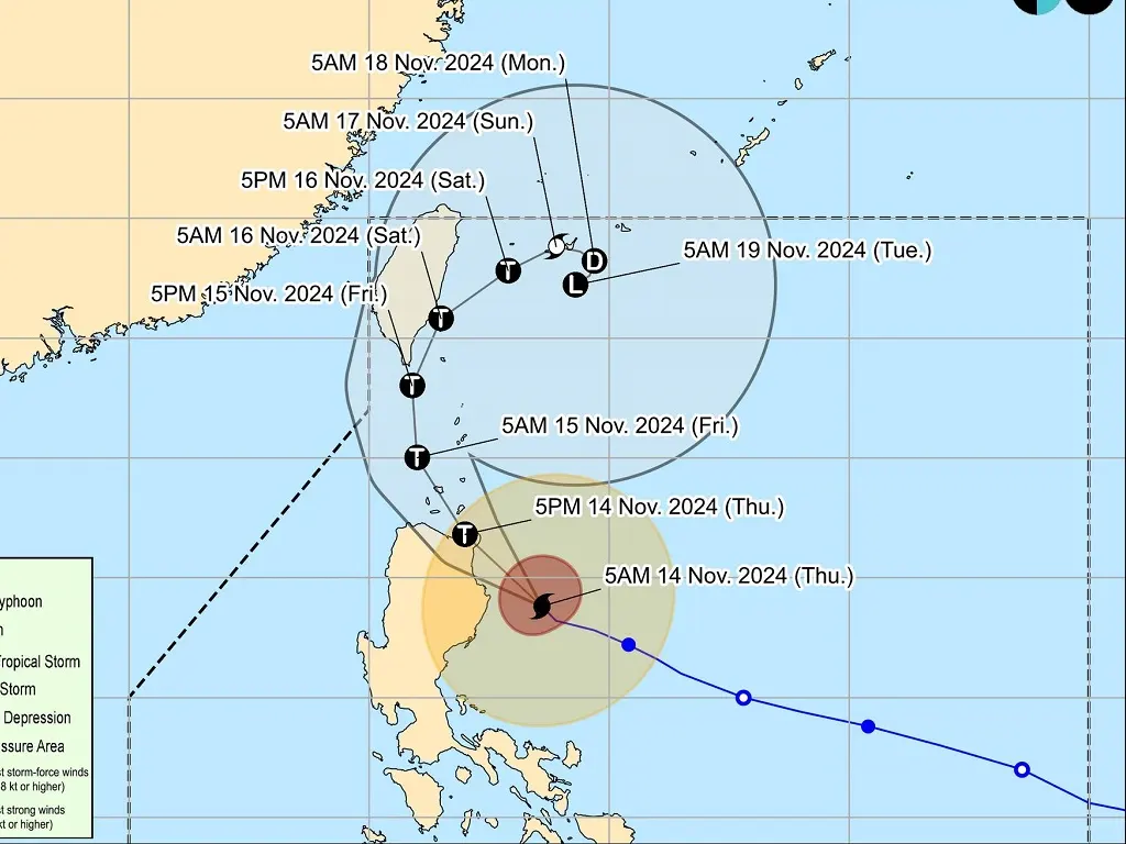
SUPER Typhoon Ofel is bearing down on the Philippines, with landfall expected along the eastern coast of Cagayan or northern Isabela this afternoon. The storm is bringing with it the threat of heavy rains, strong winds, and potential storm surges.
In response to the intensifying threat, the state weather bureau, PAGASA, has raised Tropical Cyclone Wind Signal (TCWS) No. 5 over a portion of the affected areas. Here’s the breakdown of the TCWS levels as of PAGASA’s 8 a.m. bulletin:
TCWS No. 5:
The northeastern portion of mainland Cagayan (Santa Ana, Gonzaga)
TCWS No. 4:
The southeastern portion of Babuyan Islands (Camiguin Is.)
The northern and eastern portions of mainland Cagayan (Santa Teresita, Ballesteros, Aparri, Camalaniugan, Buguey, Lal-Lo, Allacapan, Gattaran, Baggao, Peñablanca)
The northeastern portion of Isabela (Maconacon, Divilacan, Palanan)
TCWS No. 3:
Various areas including the rest of Babuyan Islands, Cagayan, Isabela, Apayao, Ilocos Norte, and more.
TCWS No. 2:
Batanes, Isabela, Quirino, Apayao, Kalinga, Abra, and more.
TCWS No. 1:
Various areas including Isabela, Quirino, Nueva Vizcaya, Mountain Province, Abra, Benguet, Ilocos Sur, Aurora, and more.
Classes suspended
Due to the intensified typhoon, several local government units have suspended classes for the day. Typhoon Ofel was last located at 165 kilometers east-southeast of Tuguegarao City, Cagayan, moving northwestward at 15 kilometers per hour with maximum sustained winds of 185 kph near the center and gustiness of up to 230 kph. Pagasa anticipates that Ofel may make landfall over Cagayan or northern Isabela on Thursday afternoon.
Pagasa also warned of possible storm surges in various areas and predicted intense to torrential rains in Cagayan and Isabela. The weather bureau emphasized the risk of severe flooding and landslides, urging residents to take precautionary measures. Areas under different TCWS levels are expected to experience varying impacts from the typhoon, from extreme to minimal.
A Gale Warning has been issued for several coastal waters, with rough to very rough sea conditions expected. Mariners are advised to avoid sea travel and seek shelter until conditions improve. Precautionary measures have been urged for small seacrafts navigating the affected areas.
metrosundaily