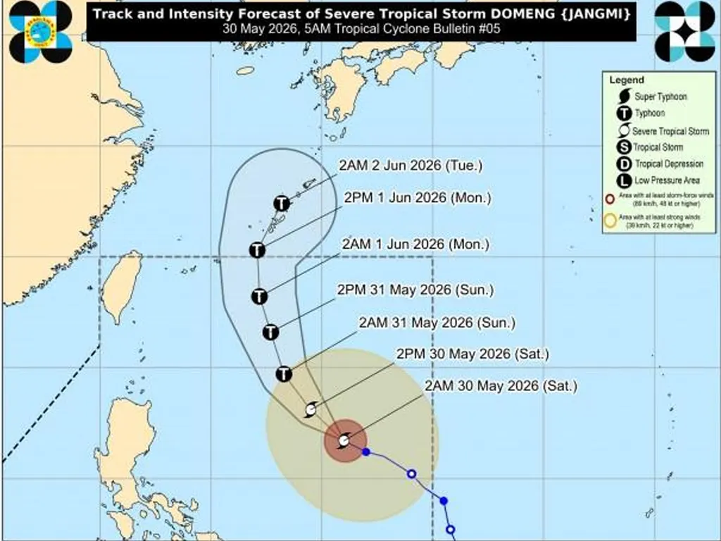
THE state weather bureau PAGASA announced early Saturday that Severe Tropical Storm Domeng has kept its strength while moving across the Philippine Sea, with its trough set to bring cloudy conditions and scattered rains to various parts of the country.
As of 4:00 a.m., the weather system was spotted 970 kilometers east of Northern Luzon, packing maximum sustained winds of 95 km/h near the center and gusts reaching up to 115 km/h. Areas expected to be affected by its trough include the Bicol Region, Batanes, Ilocos Norte, Apayao, Cagayan, Quezon, Northern Samar, Eastern Samar, and Samar, where thunderstorms and rain showers are likely throughout the day.
Domeng is forecast to move west‑northwest at 15 km/h and is projected to intensify into a typhoon by Saturday evening or Sunday morning while staying over the Philippine Sea.
According to PAGASA, the cyclone is unlikely to make landfall in any part of the country but will remain at typhoon strength before gradually weakening afterward. It is expected to exit the Philippine Area of Responsibility by Monday, June 1, though its influence will continue to be felt through weather systems such as the southwesterly windflow affecting other regions.
In the next 24 hours, cloudy skies with scattered rains and thunderstorms will also prevail over MIMAROPA, Western Visayas, Negros Island Region, Zamboanga Peninsula, SOCCSKSARGEN, BARMM, Batangas, and Lanao del Norte due to the prevailing windflow.
Metro Manila and the rest of the country, meanwhile, can expect localized thunderstorms. Mariners and coastal residents are advised that moderate to strong winds and moderate to rough seas will be experienced in Northern Luzon, while the rest of the archipelago will have light to moderate winds and slight to moderate coastal waters.
metrosundaily