TROPICAL Storm Dante has intensified, posing a significant threat to the Philippines.
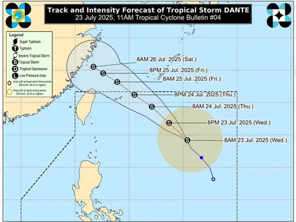
As of 10:00 AM today, Dante’s center was located approximately 900 km East of Extreme Northern Luzon (20.8°N, 130.6°E). The storm boasts maximum sustained winds of 65 km/h near its center, with gusts reaching up to 80 km/h. Its central pressure is 996 hPa, and it’s moving
North northwestward at 15 km/h. Strong to gale-force winds extend outwards up to 350 km from the center. While no Tropical Cyclone Wind Signals (TCWS) are currently hoisted, the potential for significant impacts remains high.
The enhanced Southwest Monsoon, further intensified by Tropical Storm Dante and Tropical Depression Emong, is expected to bring heavy rainfall and strong winds across large swathes of the country.
Weather Advisory No. 32 provides detailed information on the heavy rainfall outlook. Strong to gale-force gusts will affect numerous areas, particularly coastal and upland regions, beginning today and continuing into Friday.
These areas include Zambales, Bataan, Bulacan, Aurora, Metro Manila, CALABARZON, Bicol Region, MIMAROPA, Visayas, parts of Mindanao, and others.
Mariners are advised to exercise extreme caution, with small seacrafts urged to avoid venturing out to sea, particularly in areas experiencing rough to moderate seas. Residents in affected areas are urged to monitor weather updates closely and take necessary precautions to ensure their safety.
metrosundaily

