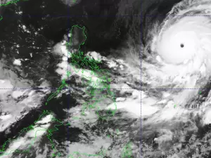
THE low-pressure area (LPA) being monitored outside of the Philippine area of responsibility (PAR) has a high chance of developing into a tropical depression within the next 24 hours, the state weather bureau PAGASA said on Tuesday.
As of 2 a.m., the LPA was spotted 1,370 kilometers east of Northeastern Mindanao and currently has no direct effect on the country. PAGASA said the LPA may enter the PAR within the day and will be named “Basyang” once it develops into a tropical depression.
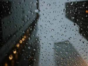
Meanwhile, the shear line and the Northeast Monsoon will continue to cause cloudy skies and rains in different parts of the country on Tuesday. The shear line is affecting the eastern sections of Visayas and Mindanao, while the Northeast Monsoon is affecting Luzon.
Visayas, Caraga, Davao Region, and Misamis Oriental will have cloudy skies with scattered rains and isolated thunderstorms due to the shear line. The Amihan will bring cloudy skies with light rains over Batanes and Babuyan Islands, and partly cloudy to cloudy skies with isolated light rains over Metro Manila and the rest of Luzon. The rest of Mindanao will experience partly cloudy to cloudy skies with isolated rainshowers or thunderstorms due to localized thunderstorms.