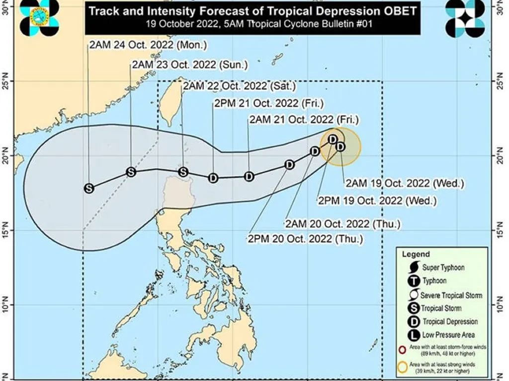
THE Philippine Atmospheric, Geophysical and Astronomical Services Administration (Pagasa) said the low pressure area (LPA) off Northern Luzon has escalated into a tropical depression that has been named “Obet”.
Daniel James Villamil, Pagasa’s weather specialist, said the center of Obet was some 1, 055 kilometers east of extreme Northern Luzon while moving north-westward at 10 kilometers per hour (kph).
He said the tropical depression has maximum sustained winds of 45kph near the center and gustiness of up to 55kph.
Villamil said Obet is not yet directly affecting the entire country as the shear line or the tail-end of the frontal system is the one that brings rains to some areas, particularly in Northern Luzon.
Based on Pagasa’s forecast, Obet may traverse toward extreme Northern Luzon or the northern portion of mainland Northern Luzon between Friday evening and Saturday morning.
“It may gradually intensify by mid-Friday as it tracks closer to extreme Northern Luzon and may reach tropical storm category by late Friday or early Saturday,” according to the weather forecaster.
Based on the latest forecast scenario, the state-run weather agency said tropical cyclone wind signal may be raised in some areas in Northern Luzon Wednesday night or Thursday at the earliest.
It said that the highest possible storm alert signal that may be raised is Signal No. 2.
Pagasa said the shear line is bringing cloudy skies with scattered rain showers and thunderstorms over Batanes, Cagayan, including Babuyan Islands, Ilocos Norte and Apayao while the south-westerly surface wind flow is affecting the Eastern Visayas where cloudy skies with scattered rain showers and thunderstorms may be experienced.
Meanwhile, partly cloudy to cloudy skies with isolated rain showers or thunderstorms may prevail over Metro Manila and the rest of the country due to the localized thunderstorms and south-westerly surface wind flow, according to the weather bureau.
metrosundaily