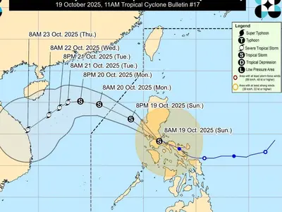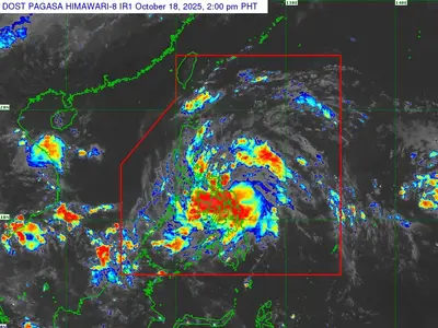
THE weather bureau said on Sunday a low-pressure area (LPA) embedded along the Intertropical Convergence Zone (ITCZ) will affect Mindanao and other parts of the country.
As of 3 p.m., PAGASA said the LPA was spotted at 220 kilometers east southeast of General Santos City, South Cotabato (5.3°N, 127.0°E).
Further, in Pagasa’s 4 p.m. weather forecast, Caraga, Davao Region, and Soccskargen will experience cloudy skies with scattered rain showers and thunderstorms because of the LPA or ITCZ.
The weather bureau said possible flash floods or landslides due to moderate to at times heavy rains may occur.
Metro Manila and the rest of the country, meanwhile, will experience partly cloudy to cloudy skies with isolated rain showers or thunderstorms caused by easterlies or localized thunderstorms.
Severe thunderstorms may result in possible flash floods or landslides.
The wind speed forecast for extreme Northern Luzon is moderate to strong, while coastal water conditions will be moderate to rough ranging from 1.2 to 3.1 meters.
Visayas, the rest of Luzon, and Mindanao have light to moderate wind speed, with slight to moderate coastal waters at 0.6 to 2.1 meters.
Photo courtesy pixabay