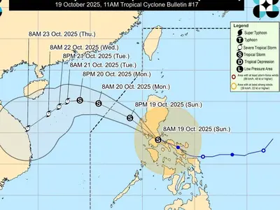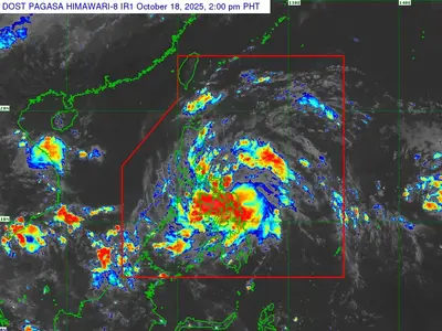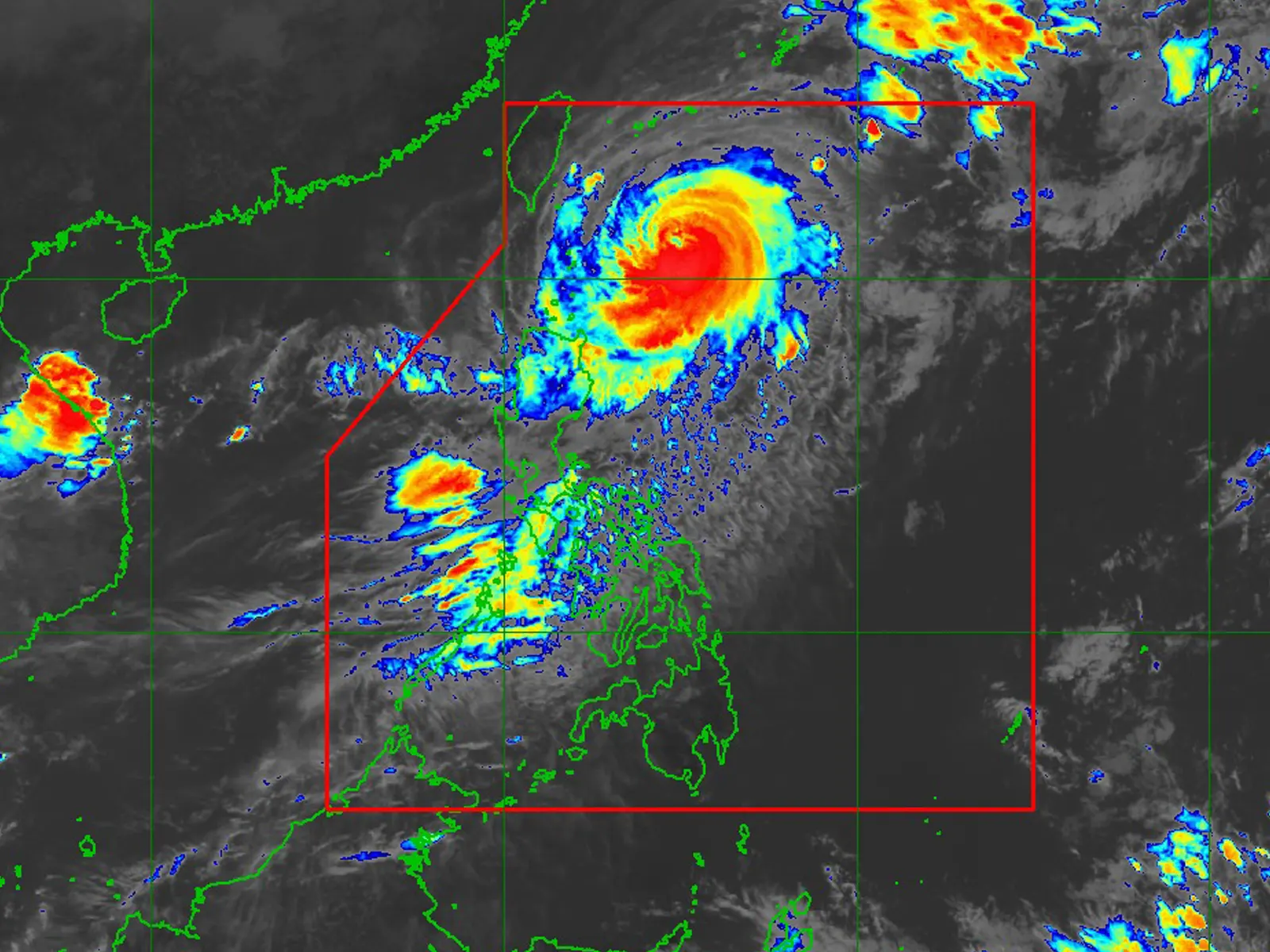
THE state weather bureau Pagasa said Tuesday the center of the eye of Typhoon Jenny was estimated based on all available data at 330 km East of Basco, Batanes or 340 km East of Itbayat, Batanes (20.7°N, 125.1°E)
Intensity: Maximum sustained winds of 155 km/h near the center, gustiness of up to 190 km/h, and central pressure of 950 hPa
Present Movement: Northwestward at 10 km/h
Extent of Tropical Cyclone Winds: Strong to typhoon-force winds extend outwards up to 560 km from the center
TROPICAL CYCLONE WIND SIGNALS (TCWS) IN EFFECT
TCWS No. 2 Wind threat: Gale-force winds
Warning lead time: 24 hours
Range of wind speeds: 62 to 88 km/h (Beaufort 8 to 9)
Potential impacts of winds: Minor to moderate threat to life and property
Luzon: Batanes
TCWS No. 1 Wind threat: Strong winds
Warning lead time: 36 hours
Range of wind speeds: 39 to 61 km/h (Beaufort 6 to 7)
Potential impacts of winds: Minimal to minor threat to life and property
Luzon: Cagayan including Babuyan Islands, the northern and eastern portions of Isabela (Maconacon, Divilacan, Palanan, Santa Maria, San Pablo, Tumauini, Cabagan, Ilagan City, San Mariano, Santo Tomas, Dinapigue, Benito Soliven, Naguilian, Gamu, Quirino, Delfin Albano, Quezon, Mallig), Apayao, the northeastern portion of Abra (Tineg, Lacub, Malibcong), the northern portion of Kalinga (Balbalan, Pinukpuk, Rizal, City of Tabuk), and Ilocos Norte
HAZARDS AFFECTING LAND AREAS
Heavy Rainfall Outlook
Forecast accumulated rainfall from today to tomorrow noon
• 50-100 mm: Batanes and Babuyan Islands
Forecast accumulated rainfall from tomorrow noon to Thursday noon
• 100-200 mm: Batanes
• 50-100 mm: Babuyan Islands and the northern portion of Ilocos Norte
Forecast rainfall are generally higher in elevated or mountainous areas. Under these conditions, flooding and rain-induced landslides are possible especially in areas that are highly or very highly susceptible to these hazards as identified in hazard maps and in localities that experienced considerable amounts of rainfall for the past several days.
In addition, JENNY will continue to enhance the Southwest Monsoon and bring occasional rains over the western portions of Central Luzon, Southern Luzon, and Visayas in the next 3 days. For more information, refer to Weather Advisory No. 6 for Southwest Monsoon issued at 11:00 AM today and 24-Hour Public Weather Forecast and Outlook at 4:00 AM today.
Severe Winds
The wind signals warn the public of the general wind threat over an area due to the tropical cyclone. Local winds may be slightly stronger/enhanced in coastal and upland/mountainous areas exposed to winds. Winds are less strong in areas sheltered from the prevailing wind direction.
• Minor to moderate impacts from gale-force winds are possible within any of the areas under Wind Signal No. 2.