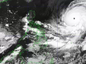
THE Philippine Atmospheric, Geophysical, and Astronomical Services Administration (Pagasa) announced Thursday afternoon that a low-pressure area (LPA) located outside the Philippine Area of Responsibility (PAR) has intensified into a tropical depression.
At 3 p.m., the tropical depression was positioned 2,730 kilometers east of Northern Luzon, moving north at 10 km/h. It has maximum sustained winds of 45 km/h near its center and gusts of up to 55 km/h.
While this system currently poses no direct threat to the Philippines, the agency continues to monitor its movement and intensity. Meanwhile, weather conditions across the country are being influenced by another LPA within PAR and the Southwest Monsoon (Habagat).
The LPA situated over the coastal waters of San Fernando City, La Union, has a medium chance of developing into a tropical depression within the next 24 hours.
This LPA, along with the Habagat, is expected to bring cloudy skies with scattered to widespread rains and thunderstorms to various regions.
The Ilocos Region and Zambales are anticipated to experience moderate to heavy rains, increasing the risk of flash floods and landslides. Similar weather conditions, potentially leading to flash floods and landslides, are forecast for Metro Manila, several regions in Luzon, and parts of Visayas and Mindanao.
The rest of the country will experience partly cloudy to cloudy skies with isolated rain showers or thunderstorms due to the Habagat. Northern Luzon can expect moderate winds and coastal water conditions, while the rest of the country will experience light to moderate winds and slight to moderate coastal waters. Sunrise in Metro Manila is at 5:41 a.m. on Friday.