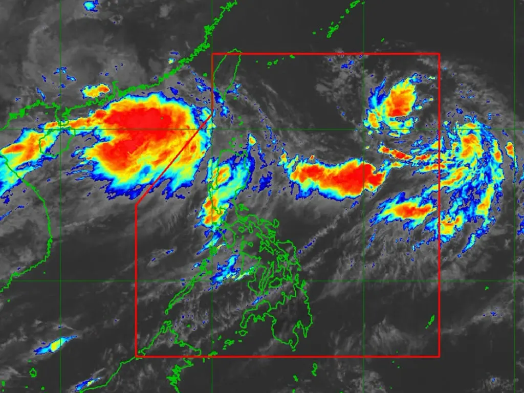
STATE weather bureau PAGASA issued Tropical Cyclone Bulletin No. 1 at 11:00 a.m. on August 30, 2026, confirming that a Low Pressure Area east of Extreme Northern Luzon has developed into Tropical Depression “Pilandok”.
At 10:00 a.m., the center of the new cyclone was estimated at 1,225 km East of Extreme Northern Luzon (20.8°N, 133.6°E), packing maximum sustained winds of 45 km/h near the center, gusts up to 55 km/h, and a central pressure of 1002 hPa. Pilandok is moving West‑Northwestward at 15 km/h, with strong winds extending outward up to 420 km from the center. No Tropical Cyclone Wind Signals have been hoisted as the system remains far from land.
Pilandok is forecast to continue moving West‑Northwestward through today before shifting toward a Northwest to North‑Northwest trajectory thereafter. PAGASA emphasized that the cyclone is unlikely to make landfall over the Philippines and will remain far from the country’s landmass throughout its lifespan. Pilandok is expected to remain a tropical depression and will be short‑lived, forecast to weaken into a remnant low over the Philippine Sea south of the southern islands of Japan by Tuesday, September 1.
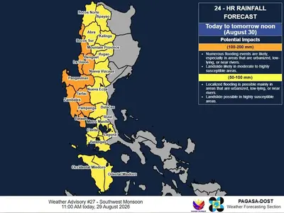
Even though Pilandok itself will stay offshore, its formation coincides with an enhanced Southwest Monsoon bringing widespread severe weather across the country. Strong to gale‑force gusts are forecast over most of Luzon and Visayas, plus portions of Mindanao, through Tuesday. Heavy rainfall from the monsoon is also expected to persist — with 100–200 mm likely across western Luzon provinces and 50–100 mm over Metro Manila and surrounding regions — as detailed in Weather Advisory No. 31 issued the same morning.
Maritime conditions are deteriorating sharply due to the combined effects of Pilandok and the monsoon. Sea conditions will range from moderate to rough, with waves reaching up to 3.5 meters along the western seaboards of northern Luzon. PAGASA strongly advised small seacraft, including motorbancas, not to venture out to sea in affected areas, while larger vessels should exercise extreme caution. The public and disaster‑response offices are urged to monitor subsequent bulletins and adhere to local warnings, with the next update scheduled for 5:00 p.m. the same day.
metrosundaily